Report on regions
The area report splits the entire map into subareas and generates a report page for each subarea. For example, you can automatically divide a map of Germany into maps of the 16 federal states or create a section map for each sales area.
Control
The controlling level determines the structure of the report. A separate map and, optionally, separate data tables are generated for each area of the controlling level selected for the report. A report can only use a map on the same sheet as the report as a reference. As controlling plane any surface plane from the selected map can be used.
You can select individual areas of the controlling level. Only for the selected areas a map section will be generated within the report. If you would like to create an overall view in addition to the individual map sections, check Include overall view.
Output Details
Here you can define details for the display of the maps in the report.
| Properties | ||
| Scale and position |
Maximal and centered |
The map is displayed as large as possible on each sheet, i.e. the map section on each sheet is set so that the area just fits into the section. |
|
Uniform and centered |
The map is displayed on each sheet with the same scale. Thus the largest area determines the scale. Smaller areas are thus displayed much smaller than would be possible. But the maps of the different sheets are comparable in scale. |
|
|
Unmodified and not centered |
The map on each sheet corresponds to the size and position of the area in the overall view of the map. |
|
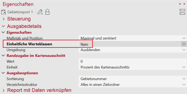
| Uniform classes | Yes |
On each sheet, the same classes are used in analyses as those specified in the definition of the analysis. Distributions such as equally distributed or equidistant are still calculated for all areas together and not only for the visible areas of the report section. |
| No | If analyses use distributions such as equidistant or equidistant, the distribution is recalculated for each sheet of the report. Since the class boundaries are thus derived from the value distribution of the visible section, each sheet can generate different classes. | |
| Surroundings | Hide |
Nothing is displayed outside the selected area. The report sets practically one clip map on each sheet to the currently displayed area. |
| Show |
Outside the selected area, the map is displayed normally. In this case only the map section is set so that the area is centered in the section (this corresponds to a zoom within the map on this area). Note: This setting is not with Uniform classes: No can be combined! |
|
| Show Partially |
Outside the selected area, only certain information is displayed. Whether a level is displayed or not depends on the setting Visibility: In Reports of the respective level. By default, area levels and analyses are not displayed outside the area, but boundaries and topographic information are. |
|
| Margin
By default, the areas on each sheet of the report are fitted into the map as much as possible, taking into account the settings under Properties. However, you have the option of displaying a certain part of the map around each area that does not belong to that area. This can be useful to represent the environment of each area. You can use the settings in this block to specify the size and calculation mode of this margin addition. |
||
| Value | Sets the size of the border allowance in percent or in actual kilometers of the map, depending on the setting for unit. | |
| Unit |
Kilometers |
The section is set so that around each area an area of X kilometers is visible on each side (depending on the setting in Value). |
|
Percentage of the view dimensions |
The section is set so that an environment of X percent of the area size is visible around each area (depending on the setting in Value). The visible environment is therefore smaller in small areas (measured in kilometres) than in large areas. |
|
| Output options
This setting is important when reports are used in export functions. For printing it does not matter. |
||
| Sort table | Territory name / Territory number |
The output is sorted either by the area name or by the Territory number. Note: This setting is important when reports are used in export functions. It doesn't matter for printing. |
|
Folder structure |
Create a single target folder |
All outputs of this report are saved in a folder that is specified during export. |
|
Create a hierarchical folder structure |
Subfolders may be created below the folder specified during export. In a multi-level area organization, subfolders are first created for the highest level of the territory organization (the largest territory), below which subfolders are created for the next finer level, and so on. This setting can help to keep the results from different exports (e.g. graphics and data export) clearly arranged. |
|
Link data with the report
It is possible to add one or more data tables to the report maps. If this is desired, first select the Table or query whose data are to be included in the report. Then choose Column, which contains the number of the areas of the controlling level of the report.
If you export the data to this report, the corresponding data records are filtered for each area of the controlling level. For example, you can create a table of customers for each sales area or a list of districts for each federal state.
Adapt analysis to an area report
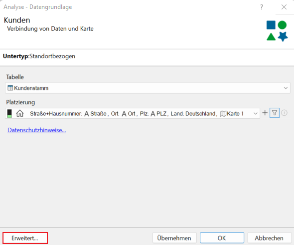
In easymap there is a possibility to adapt an analysis to an area report. When creating an analysis, under Extend, you can activate the function Only the data visible in the island view. 
This function can also be activated subsequently by opening the data bases of the analysis in the context menu of the analysis in the Contents control window.

First, we need to set the Uniform value classes under the properties of the area report to no.

..and link the data to the area report for analysis:
Allows right-click on the analysis in the Content control window and select the Ignore filter option.
With this option, only the data records in the area are displayed in island displays and reports, and the legend is adapted accordingly.
Tips for Territory Structures
The clip map section of territory reports based on territory structures created with easymap is always large enough to display also external territory locations. If the size of the clip map is too large for you, you can hide the layer of territory locations in the control window.

