Data structure
The tables necessary for the description and management of a territory structure are automatically generated by easymap when creating a new territory structure.
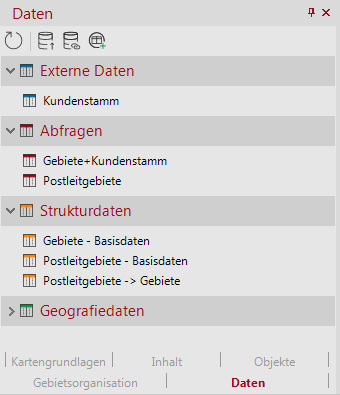
easymap needs very specific structural data to describe and manage a territory structure. For each territory level and each location level in the territory structure there is a table of basic data. The assignments of the bricks to the territories in the directly superior level are stored in assignment tables. Furthermore, easymap also keeps assignment tables for the assignment of locations to territories.
If there is no external data available to initialize the tables, easymap fills the tables with the minimum required content. These tables are interactive, i.e. you can use them to change territory data and assignments.
Although the division into structural data (basic data and allocations) and additional data is ideal for data management by the software, it is unwieldy and confusing for the user. Therefore easymap offers so-called territory work tables. These summarize basic data, assignments and additional data per territory or location level in a common table view. They are based on queries.

Structural data: Basic data + assignments
Each territory level contains the properties of the territories in a basic data table. The basic data includes those data that are directly necessary for the functioning of the territory organization. In contrast, the additional data represent data that can be added by the user, but are not absolutely necessary for structural relationships.
Basic data can be entered directly when creating a territory or location level, or can be loaded or added later using the Load basic data command. The basic data can be edited via the work tables or alternatively via the properties of a territory.
The structure data tables contain the following fields:
| Basic data of the basic modules | |
|---|---|
| Area ID | Area code of the basic building block level, depending on the base map, it varies in length (postal code areas 5 digits, municipalities 8 digits). |
| name | The name of the area from the base map. |
| possibly others, depending on the type of base map | |
| Basic data of the territory | |
|---|---|
| Area ID | The unique number (or "key") of the territory. This can also contain alphanumeric characters. For hierarchical numbers, the assignment is also coded in the number, so changing the number can change the assignment. |
| name | The name of the territory. This is used by default for territory labels and is used in some dialogs. Unlike the number, the name does not have to be unique. |
| Color | Colour used to indicate this territory on the map, in tables and in the organisation chart. You can only enter a color value here. Additional display properties such as transparency, etc. can be set in the properties of a layer. |
| Locking | Saves the State of lock of a territory (released, area protection or full lock). This property is not shown in the territory properties. |
| In addition, territories still have the following read-only data: | |
| Weight | Shows the weighting of the area. The default weighting of the territory is 100%. |
| Area Size | area of this territory. |
| Polygon Count | Number of geometrically non-contiguous sub-areas that make up this territory. |
| Bricks | Number of bricks directly subordinate to this territory |
| Elementary bricks | Number of basic building blocks indirectly subordinate to this territory |
| Locked Assignments | Number of locked assignments (assignments with validity protection) that refer to this territory. |
| Assignments (bricks to territory) | |
|---|---|
| Elementary brick | Number (and name) of the brick level. |
| Territory | Number (and name) of the assigned territory level. |
| Assignment Locking | Indicates whether the assignment is free or inventory protected. For details, see chapter lockings. |
| Basic data of the territory locations | |
|---|---|
| Location ID | The unique number (or "key") of the territory location. This can also contain alphanumeric characters. The location number is independent of the number of the corresponding territory and does not necessarily have to be the same. |
| Location Name | The name of the territory location. This is used by default for location labels and is used in some dialogs. In contrast to the location number, the designation does not have to be unique. |
| Weight | Weighting or capacity of the site in %. You can use this value to force certain assignment ratios between locations during optimizations (see area optimization - additional optimization options). |
| Territory | Displays the territory to which the location is assigned. If multiple assignment is not allowed, this property can also be changed. Otherwise, you must work with the assignment table. |
| Located in territory | Indicates whether the location is within the area of the assigned territory. |
| Latitude (LAT) | Geographic latitude - Sets the location of the location. |
| Longitude (LON) | Geographic Longitude - Sets the location of the location. |
| Elementary brick | Indicates the basic building block in which the location is located. You can also change this value to place the location on the center of another brick. The values for latitude and longitude will also be adjusted. |
| Assignment Locking | For details, see chapter lockings. |
Note: The column "Territory" is only displayed in the basic data of the sites if multiple assignments between territories and territory sites are not permitted. There is a duplicate of the column "Number (territory)" in the table of assignments of territories to territory locations.
| Assignments (Territory to Territory Sites) | |
|---|---|
| Number (Territory) | |
| Number (Location) | |
| Assignment Locking | For details see chapter lockings. |
Imported and linked structural data
For all data managed by easymap, the origin of the data is one of the decisive factors for the processing options available. Structure data tables can be transferred to easymap either from imported or linked external data. This is useful, for example, if numbers and names of territories already exist elsewhere (e.g. in an Excel spreadsheet, a database or a CRM system).
Note:
- All changes to the territory structure (adding and deleting territories as well as territory and border changes) are always stored by easymap only in its internal structure data tables. They are not updated or synchronized by easymap in the data source.
- It is recommended that you temporarily import external data that is only to be used to initialize the structure data tables. Otherwise, easymap will continue to import this external data, which is only used once. This can lead to confusion between the original external data and the internal structure data that has changed in the meantime.
- You can also use linked structure data only for initialization. In this case easymap uses the current content of the linked external data to initialize its structural data. Subsequently, all changes to the territory structure are possible. Although the external data is linked, easymap does not transfer changes of this data to its internal structure data tables.
- If linked structural data should not only be used for initialization, but changes of structural data with data / update should be transferred to easymap, then no changes of structural data can be made in easymap. Adding and deleting of territories as well as changes of territories and borders are not possible in this case. easymap is only used for visualization of territory structures whose description data is maintained and updated at another data source.
