Color Optimization
easymap can automatically assign easily distinguishable colors to the territories. This can already be done in the course of territory optimization (see additional option in the last step of the Territory Optimization Wizard). However, the automatic assignment of new colors in the course of territory optimization should be avoided if you have balanced existing territories and want to keep the colors for better comparability with the status quo.
Types of color optimization
Color optimization is also possible independently of area optimization (see menu Territory organization and context menu for control window Territory organization). For color optimization, three different color assignment methods can be selected:
Of course, you can change the colours of each territory manually afterwards for each variant. To do this, right-click on a territory on the map and select the Properties command from the context menu. Alternatively, you can also click on the color field for a territory in the Territory work table and then select a different color.
Allow
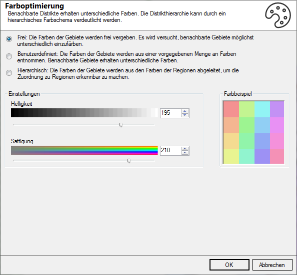
With the variant color optimization/free each territory gets a different color. easymap generates as many different colors as there are territories. Neighboring territories are given easily distinguishable colors. This procedure naturally leads to very colorful maps if there are many territories.
The color settings such as brightness and saturation can be found at the bottom of the Color Optimizer Type dialog box.
User-Defined
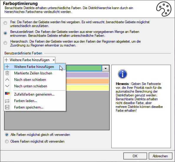
With the variant color optimization/user-defined the user specifies a limited number of colors. At least 4 colors should be selected to achieve an optimal result. easymap distributes the given colors over the territories in a way that neighboring territories get different colors. This procedure leads to a well readable map image even if there are many territories. However, this variant assigns the same color to several territories.
Add Colors automatically adds another color. You can also remove colors from this list using Delete Marked Lines or adjust them by clicking on the color area.
The functions Shift up and Shift down allow you to change the order of the colors.
Generate Random Colors allows you to determine the brightness and saturation of the selected colors.
As in other dialogs, you can also save these colors (as *.PAL) and use them in other territory organizations, for example, and load them again at this point.
In the radio button you can additionally set whether all colors should be used as often as possible or whether as few colors as possible from the selected color palette should be used.
Hierarchical

With the variant color optimization/hierarchical easymap derives the colors of the territories from the colors of the superior territories. The colors of all territories in a region are based on the color of the region the territories belong to. The colors of the territories within a region differ only in the hue. This system of color assignment means that not only the territories can be easily distinguished from each other. It also makes it easy to recognize which territories belong to the higher-level territorial units. This variant of color optimization is of course only applicable for territory structures with several levels.
