Map export
The map export is an additional function in the easymap can be exported without any problems. The map elements are exported in separate layers (lines, areas, labels). The possible export formats are ESRI Shapefile, MapInfo TAB, KML and Geo JSON. The map export is located under the menu item File > Export > Maps.
Territory structures may be exported in these formats as well as in refx2. For more information about exporting territory structures, see here.
Exporting a map
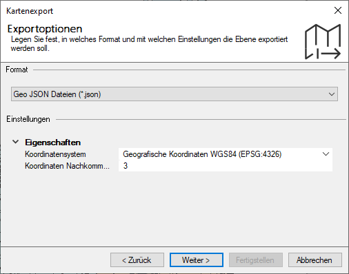
Select the menu item File and the command Export > Maps. A dialog window will open where you can specify the layer for the map export. Then specify the format and coordinate system in which the layer should be exported.
When exporting territory structures that are to be set up, you can define additional characteristics in the settings.
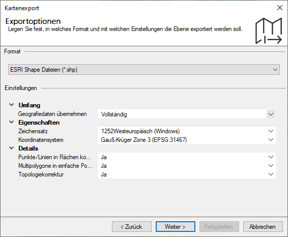
The geodata is saved in the format you have selected. You can drag and drop the geodata directly onto the sheet in easymap using Drag&Drop.
Special export
The base maps included in easymap have the file extension *.LTG. The export of own maps using .LTG-base maps or aggregates based on these base maps (e.g. a territory structure) is not possible without further ado. For the map export a specially licensed base map is required (*_XP.LTG or *_XPA.LTG). The corresponding LTGs are available on Request.
Base Maps
Basically you can distinguish between two different licenses for base maps:
- (*XP.LTG): The base map itself may be exported into other formats.
- (*XPA.LTG): Only the export of a territory structure based on the base map is allowed.
You can easily find out which license is available for the respective base map by looking up the name of the base map. In the properties of the base map, you will find the name under Total level. If the name ends with *XP.LTG, the export of the base map itself is possible. If only aggregates may be exported, the base map ends at *XPA.LTG.
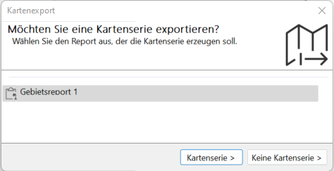
Map export with area report
Easymap offers the possibility to export a map with an area report also as a map base. The whole map is divided into subareas and a map base is generated for each subarea. If a map folder contains an area report, you will be asked during the map export whether the export should be created with map series or without map series: